Are you looking for some ways to help teach your students about the political boundaries in Europe and how they've changed throughout the 20th and 21st centuries - particularly what Europe looked like before World War I, after World War I, after World War II, and after the Cold War? I have some resources that will help!
This map activity includes 2 maps. The first set helps students understand what Europe looked like at the start of World War I as well as what country fought on which side of the war. The second set helps students understand how the political boundaries changed after World War I including which countries lost territory and what new countries emerged.
This map activity includes 2 maps. The first set helps students understand the political boundaries of Europe after World War II. Students will also learn what countries belonged to NATO, which ones joined the Warsaw Pact, and which countries were not aligned with either. The second included map examines Europe after the collapse of the Soviet Union and the end of the Cold War. Students will identify the new countries that emerged as the political boundaries of Europe drastically changed.
Both of these map activity sets include both print and digital versions. The print versions include PDFs with a blank map and a coloring page map (one that is already labeled but needs to be colored for students who need more scaffolding). The included PowerPoint takes students step by step through the labeling and coloring of the map making it a no-prep lesson for teachers. The digital maps are already colored and students drag and drop labels using a PowerPoint or Google Slides version. There's also an online, self-checking map for students to review with!
If you are looking for a modern map of Europe, this set on the countries and capitals of Europe may be just what you need! It includes 5 maps. 4 of the map sets break down Europe into more manageable regions - Northern, Eastern, Western, and Southern. The final map set is a full map of Europe. Once students can successfully identify the locations of countries in each of the regions, they can more easily tackle the full map. On each map, students will label major bodies of water and the European countries. Handouts are included in each set for students to list the capitals of each of the countries. This download also includes digital versions so it is easy to use with hybrid classes and remote students.
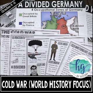
This mini-lesson will help your students understand how Europe's borders changed after World War II, during the Cold War, and after the collapse of the Soviet Union. You can use this as guided notes, station work, homework, in an interactive notebook, and much more!
This PowerPoint and guided notes lesson covers the Cold War from its beginning to the collapse of the USSR including the United Nations, the Iron Curtain, the Truman Doctrine and Marshall Plan, a divided Germany, Berlin, and Austria, the Arms Race, the Soviet Union under Khrushchev, Brezhnev, Andropov, Chernenko & Gorbachev, Cuba (Castro, Bay of Pigs Invasion, Cuban Missile Crisis), SALT and START, the collapse of Soviet Union and establishment of Russian Federation, the Soviet Satellites (Yugoslavia, East Germany, Poland, Hungary, Czechoslovakia, Romania, Albania), the Korean and Vietnam War, and China becoming Communist.
I hope you find these helpful!


No comments
Thank you for leaving a comment! Comments must be approved before they are posted so there will be a delay in submitting a comment and seeing it on the site.